File:Geohydromap.jpg
From eagle-rock.org
No higher resolution available.
Geohydromap.jpg (627 × 453 pixels, file size: 288 KB, MIME type: image/jpeg)
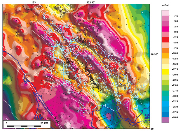
Geologic mapping currently is being conducted here as part of the 3D Geologic Maps and Visualization Project. "Understanding Geohydrology, USGS.
File history
Click on a date/time to view the file as it appeared at that time.
| Date/Time | Thumbnail | Dimensions | User | Comment | |
|---|---|---|---|---|---|
| current | 03:51, 28 February 2012 | | 627 × 453 (288 KB) | Charles (talk | contribs) | Geologic mapping currently is being conducted here as part of the 3D Geologic Maps and Visualization Project. "Understanding Geohydrology, USGS. |
You cannot overwrite this file.
File usage
The following page uses this file: